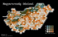
Magyarország Oázisai

| projection | UTM Zone 34N |
|---|---|
| tools | python: geopandas, matplotlib, h3 for hexagons
|
| data | OpenStreetMap contributors |
| font | Deja Vu Sans Mono |
| comments | Pleased with this one, even if it does fall foul of xkcd's very valid criticism, as pub density is likely to be synonymous with population density; labels are placed consistently to the left of the marker, unfortunately this means Szombathely overlangs the border, and that's annoying; pleased with legend; title could be nicer |
| date | 04/11/2024 |